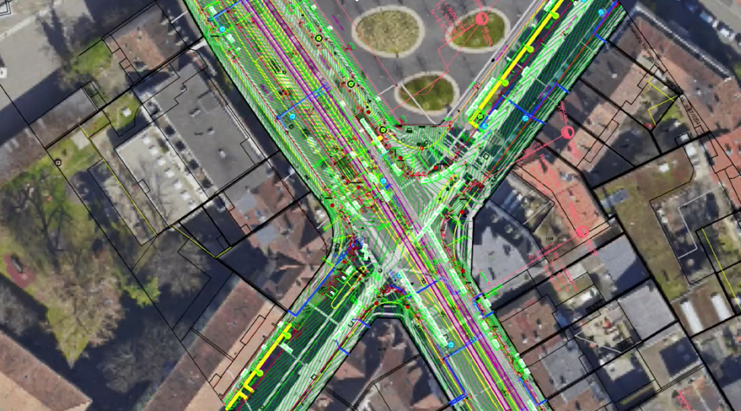
 Incorporate georeferenced imagery right into your design file. Triangle Park design courtesy of PWP Landscape Architecture.
Thanks to Esri’s ArcGIS online capabilities, third party imagery will help keep smaller file sizes without bogging down document performance. The georeference essentially exists as a background image that you can pan and zoom according to your document’s internal origin. You can link everything to the same coordinate system — and for site models, there’s a new option to incorporate geoimages as textures in 3D views.
Along with reworked dialog boxes, these improvements mean that seeing your drawing in real-world context is much quicker, easier, and more accurate.
Incorporate georeferenced imagery right into your design file. Triangle Park design courtesy of PWP Landscape Architecture.
Thanks to Esri’s ArcGIS online capabilities, third party imagery will help keep smaller file sizes without bogging down document performance. The georeference essentially exists as a background image that you can pan and zoom according to your document’s internal origin. You can link everything to the same coordinate system — and for site models, there’s a new option to incorporate geoimages as textures in 3D views.
Along with reworked dialog boxes, these improvements mean that seeing your drawing in real-world context is much quicker, easier, and more accurate.
TEASER TUESDAY: GIS IMPROVEMENTS
Seeing your project in real-world context is a powerful option, and Vectorworks 2020 makes it easy with Geographic Information System (GIS) improvements.
We’ve had GIS capabilities in Vectorworks for a while. In version 2019, the GIS toolset supports a somewhat cumbersome workflow where users have to manually import georeferenced imagery, which could take more time than desired.
Incorporate georeferenced imagery right into your design file. Triangle Park design courtesy of PWP Landscape Architecture.
Thanks to Esri’s ArcGIS online capabilities, third party imagery will help keep smaller file sizes without bogging down document performance. The georeference essentially exists as a background image that you can pan and zoom according to your document’s internal origin. You can link everything to the same coordinate system — and for site models, there’s a new option to incorporate geoimages as textures in 3D views.
Along with reworked dialog boxes, these improvements mean that seeing your drawing in real-world context is much quicker, easier, and more accurate.